[vc_row rt_row_background_width=”default” rt_row_style=”default-style” rt_row_borders=”” rt_row_paddings=”true” rt_bg_effect=”classic” rt_bg_image_repeat=”repeat” rt_bg_size=”cover” rt_bg_position=”right top” rt_bg_attachment=”scroll” rt_bg_video_format=”self-hosted”][vc_column width=”2/3″ rt_wrp_col_paddings=”false” rt_border_top=”” rt_border_bottom=”” rt_border_left=”” rt_border_right=”” rt_border_top_mobile=”” rt_border_bottom_mobile=”” rt_border_left_mobile=”” rt_border_right_mobile=”” rt_bg_image_repeat=”repeat” rt_bg_size=”auto auto” rt_bg_position=”right top” rt_bg_attachment=”scroll”][vc_column_text]Geoserve can deliver you 3D data from any part of the world. This 3D data, derived from satellite imagery, is used in various applications: simulators (aviation, maritime, etc.), serious gaming, city modeling, and visualization.
As it is geometrically correct and accurate, the 3D data is also used for engineering and modeling. Oil & gas engineers use this 3D data for pipeline routing. Scientists insert our 3D data in their models: flood risks, irrigation, noise propagation, landslides, line of sight analysis, etc.
We offer several types of 3D data:
- Digital Elevation Models, more information
- Stereo satellite imagery
- 3D surface models – a satellite image draped over an elevation model (with texture on all sides)
- Point clouds
For more information please contact Geoserve.[/vc_column_text][/vc_column][vc_column width=”1/3″ rt_wrp_col_paddings=”false” rt_border_top=”” rt_border_bottom=”” rt_border_left=”” rt_border_right=”” rt_border_top_mobile=”” rt_border_bottom_mobile=”” rt_border_left_mobile=”” rt_border_right_mobile=”” rt_bg_image_repeat=”repeat” rt_bg_size=”auto auto” rt_bg_position=”right top” rt_bg_attachment=”scroll”][vc_column_text]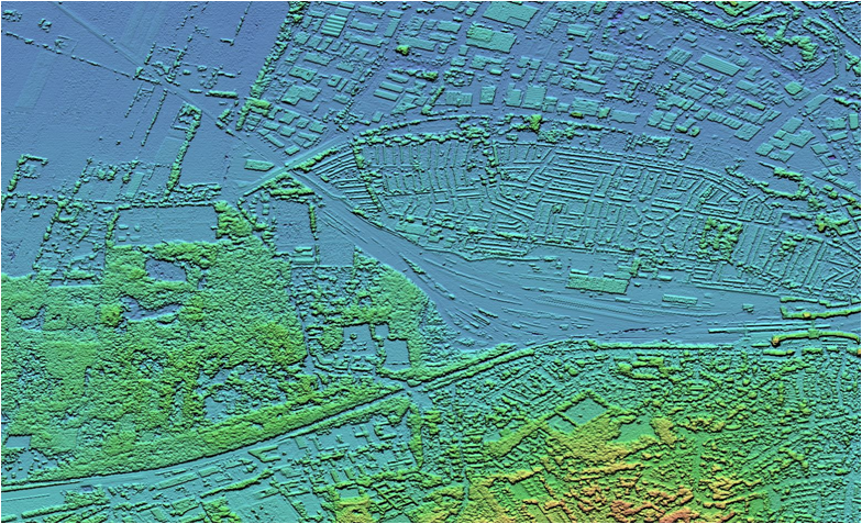
Digital Elevation Model of Amersfoort, the Netherlands[/vc_column_text][vc_column_text]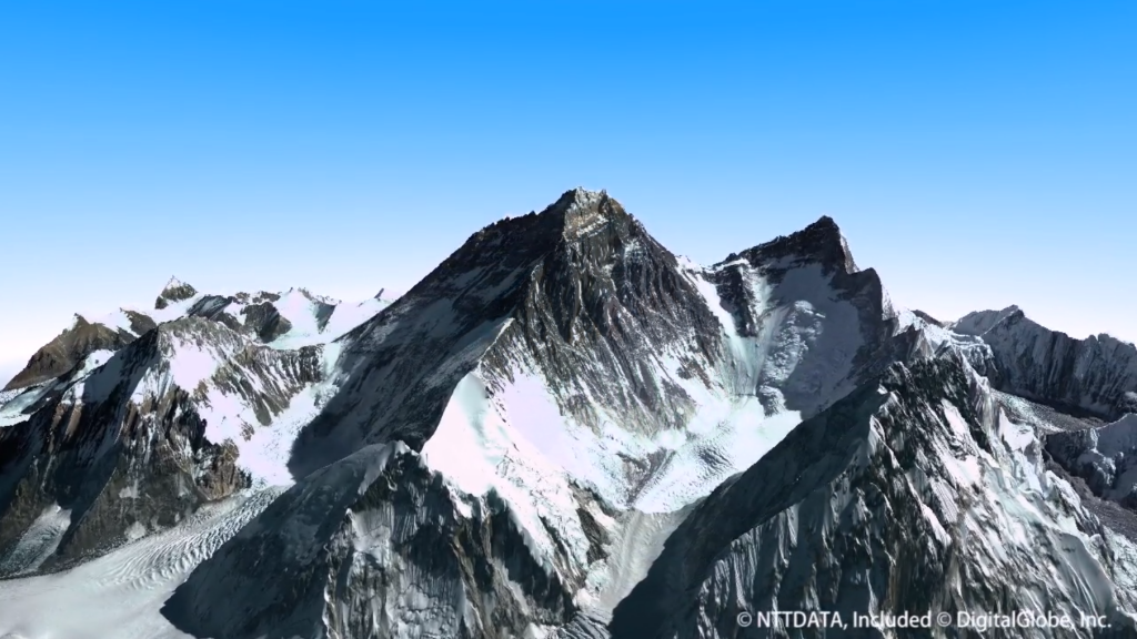
3D visualization of the Mount Everest[/vc_column_text][/vc_column][/vc_row]