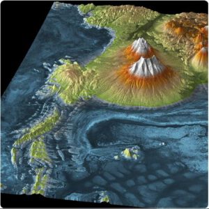
Two types of elevation models are available: Digital Surface Models (DSM) and Digital Terrain Models (DTM). A DSM represents the earth’s surface including all objects on it (such as trees and buildings). A DTM shows the bare ground surface with these objects removed.
Geoserve is a distributor for all major DEM providers, including Airbus, Intermap, RESTEC and Vricon. Below table only shows a selection of available elevation models. Please contact Geoserve for other options.
| Product | Grid size (in meters) | Height accuracy (Z)* | Age of source data | Price per km2** |
| AW3D Enhanced DSM | 0.5 x 0.5 | 3 meters LE90 | 2008 – now | EUR 45.00 |
| AW3D Enhanced DTM | 0.5 x 0.5 | 3 meters LE90 | 2008 – now | EUR 63.00 |
| Vricon DSM | 0.5 x 0.5 | 3 meters LE90 | 2010 – now | EUR 24.00 |
| Vricon DTM | 0.5 x 0.5 | 3 meters LE90 | 2010 – now | EUR 30.00 |
| NEXTMap 1 DSM | 1 x 1 | 3 meters LE90 | 2016 – 2018 | EUR 9.00 |
| NEXTMap 1 DTM | 1 x 1 | 3 meters LE90 | 2016 – 2018 | EUR 14.00 |
| Elevation 1 DSM | 1 x 1 | 10 meters LE90 | new collection | EUR 55.00 |
| Elevation 1 DTM | 1 x 1 | 10 meters LE90 | new collection | EUR 65.00 |
| AW3D DSM 2.5 | 2.5 x 2.5 | 5 meters RMSE | 2006 – 2011 | EUR 6.00 |
| AW3D DTM 2.5 | 2.5 x 2.5 | 5 meters RMSE | 2006 – 2011 | EUR 14.80 |
| Elevation 4 DSM | 4 x 4 | 10 meters LE90 | new collection | EUR 25.00 |
| Elevation 4 DTM | 4 x 4 | 10 meters LE90 | new collection | EUR 35.00 |
| WorldDEM NEO DSM | 5 x 5 | 2.5 meters LE90 | 2017 – 2021 | EUR 10.00 |
| AW3D DSM 5 | 5 x 5 | 5 meters RMSE | 2006 – 2011 | EUR 4.50 |
| AW3D DTM 5 | 5 x 5 | 5 meters RMSE | 2006 – 2011 | EUR 14.80 |
| NEXTMap 5 DSM | 5 x 5 | 1 meter RMSE | 2007 | EUR 4.50 |
| NEXTMap 5 DTM | 5 x 5 | 1 meter RMSE | 2007 | EUR 6.50 |
| Euro-Maps 3D DSM | 5 x 5 | 5 – 10 meters LE90 | 2005 – now | EUR 7.00 |
| Elevation 8 DSM | 8 x 8 | 10 meters LE90 | new collection | EUR 8.00 |
| Elevation 8 DTM | 8 x 8 | 10 meters LE90 | new collection | EUR 12.00 |
| NEXTMap 10 DSM | 10 x 10 | 10 meters LE95 | 2000 – 2008 | EUR 0.50 |
| NEXTMap 10 DTM | 10 x 10 | 10 meters LE95 | 2000 – 2008 | EUR 1.50 |
| WorldDEM DSM | 12 x 12 | 2.5 meters LE90 | 2011 – 2014 | EUR 5.00 |
| WorldDEM DTM | 12 x 12 | 2.5 meters LE90 | 2011 – 2014 | EUR 11.00 |
| SRTM30 | 30 x 30 | 16 meters LE90 | 2000 | Free (handling fee only) |
*: This absolute accuracy is achieved without the use of ground control points (GCP) or other reference data. The accuracy can be improved by using GCPs.
**: The price is indicative and is exclusive 21% VAT. The price depends on the size of the area and the currency exhange rate.