| Product | Spatial resolution (GSD) | Location accuracy (CE90)* | Spectral bands** | Archive | Price per km2*** | Sample image |
|---|---|---|---|---|---|---|
| Pleiades Neo | 0.30 m | 5 m | 6 VNIR | 2021 – now | EUR18.00 |
 © Airbus, 2022 |
| Superview Neo | 0.30 m | 9.50 m | 4 VNIR | 2022 – now | EUR18.00 |
 © Spacewil, 2023 |
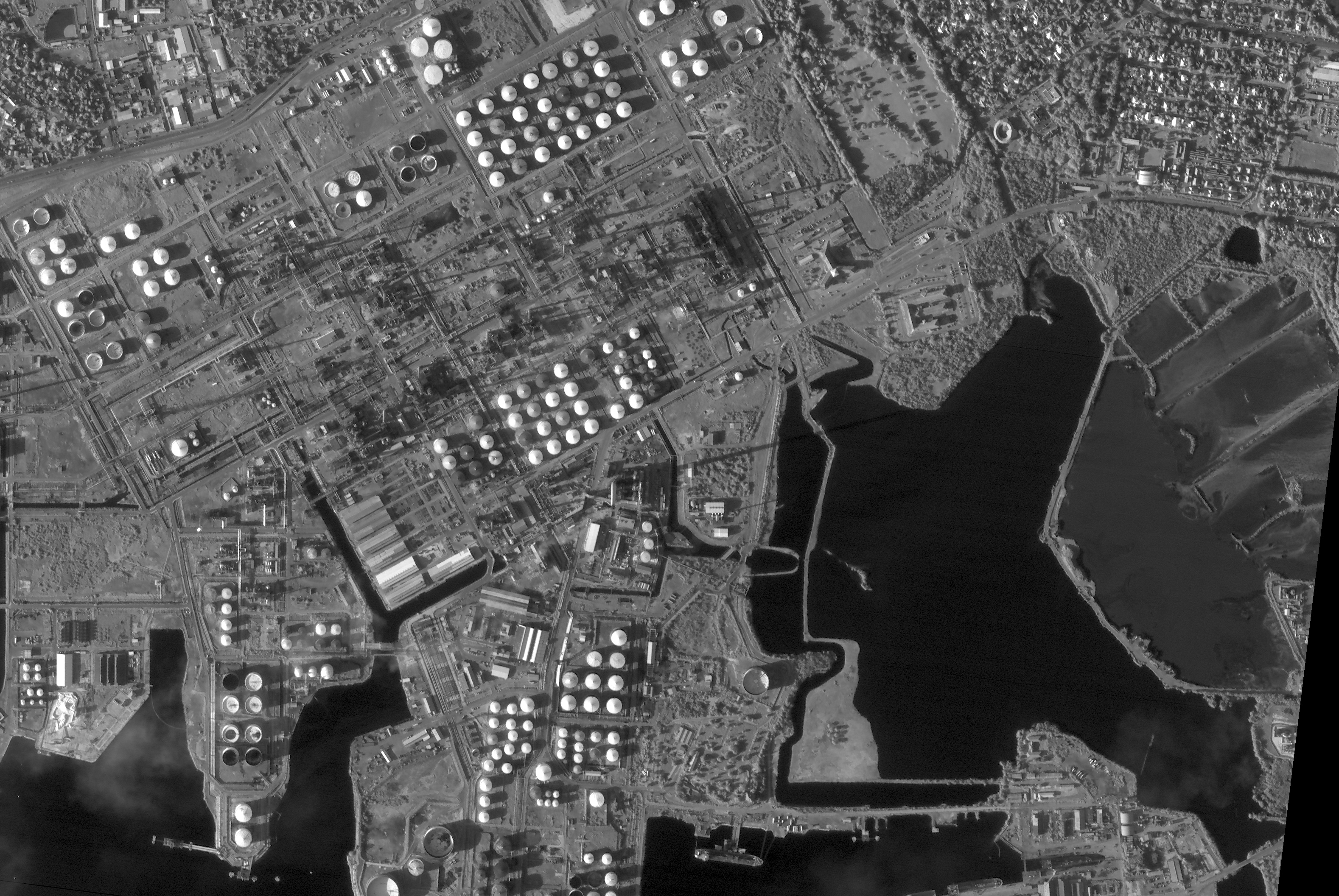
| Worldview-3 | 0.31 m | 3 m | 8 VNIR + 8 SWIR | 2013 – now | EUR20.50 |
 © European Space Imaging, 2014 |
| Worldview-4 | 0.31 m | 3 m | 4 VNIR | 2017 – 2019 | EUR20.50 |
 © European Space Imaging, 2017 |
| GeoEye-1 | 0.41 m | 4 m | 4 VNIR | 2008 – now | EUR18 |
 © European Space Imaging, 2017 |
| Worldview-2 | 0.46 m | 4 m | 8 VNIR | 2009 – now | EUR16 |
 © European Space Imaging, 2017 |
| Beijing-3 | 0.50m | 10m | 4 VNIR | 2021 – now | EUR11 |
 |
| Superview-1 | 0.50 m | 20 m | 4 VNIR | 2017 – now | EUR13 |
 © SpaceView, 2017 |
| Worldview-1 | 0.50 m | 4 m | 1 pan | 2007 – now | EUR13 |
 |
| Kompsat-3A | 0.55 m | 11 m | 4 VNIR | 2015 – now | EUR7.50 |
 © SIIS, 2016 |
| SkySat | approx. 0.60m | 10 m | 4 VNIR | 2014 – now | EUR10.80 |
 |
| Quickbird | 0.61 m | 23 m | 4 VNIR | 2001 – 2014 | EUR16 |
 © European Space Imaging, 2010 |
| Pleiades-1A/B | 0.66 m
(product pixel size = 0.5 m) |
7 m | 4 VNIR | 2012 – now | EUR10 |
 © Airbus, 2016 |
| Kompsat-3 | 0.7 m | 30 m | 4 VNIR | 2012 – now | EUR7.50 |
 © SIIS, 2014 |
| Ikonos | 0.82 m | 9 m | 4 VNIR | 1999 – 2015 | EUR9 |
 © European Space Imaging, 2011 |
| TripleSat |
0.95 m (product pixel size = 0.8 m) |
50 m | 4 VNIR | 2015 – now | EUR5 |
 © 21AT, 2017 |
| Deimos-2 | 1.0 m | 100 m | 4 VNIR | 2014 – now | EUR6 |
 © Deimos Imaging, 2015 |
| TeLEOS-1 | 1.0 m | 100 m | 1 pan | 2016 -now | EUR3.50 |
 |
Notes:
*: This accuracy is achieved without the use of ground control points (GCP) or other reference data. The accuracy can be improved by using GCPs.
**: VNIR are visible and near-infrared bands, SWIR are short-wave infrared bands, pan is the panchromatic (black & white) band.
***: The price is indicative and is exclusive 21% VAT. The price depends on the size of the area, number of users and the currency exhange rate.