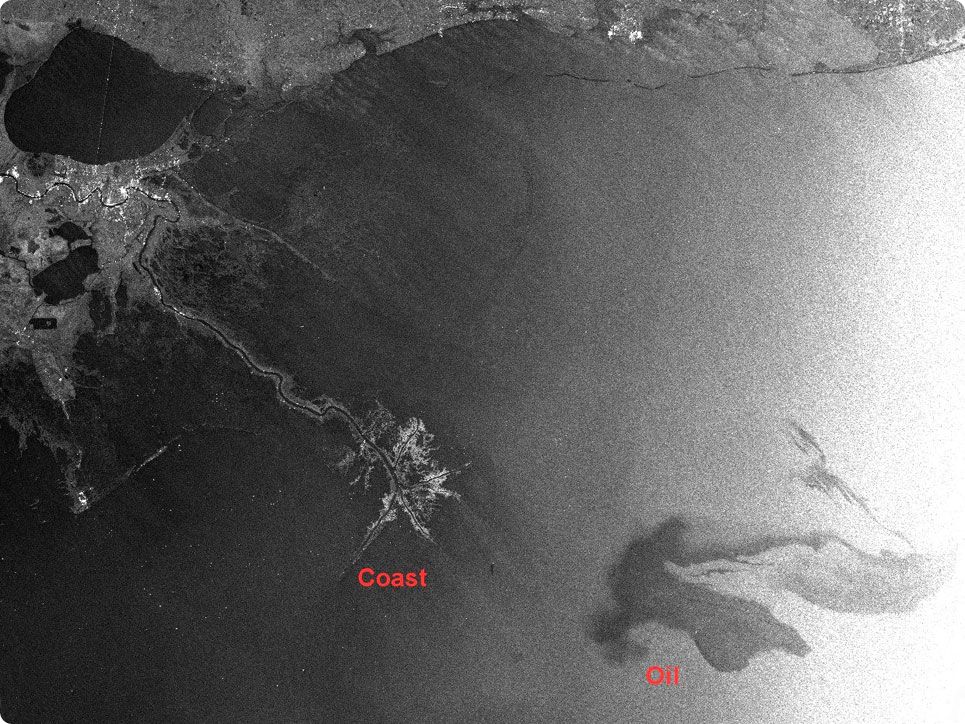
Satellite images are used for tracking oil pollution around the sinking oil plaform offshore in the Gulf of Mexico. On this radar satellite image is seen that the oil slick is just a few tens of kilometers away from the coast. The oil slick has a length of around 100 kilometers. The oils spill is maybe the biggest ever.
This image is tasked with the sensor Envisat-ASAR 26 of April, copyright ESA 2010. Geoserve provides to specialized companies which can detect and track oil pollution. These kind of images can be delivered in less than 30 minutes after tasking world wide!